
Preface
Chapter I - Introduction
Chapter II - Mammoth Cave
Chapter III - The Carter Caves
Chapter IV - Cumberland Falls
Chapter V - Cumberland Gap
Chapter VI - Natural Bridge
Chapter VII - The "Breaks of Sandy
Chapter VIII - "In Between the Rivers"
Chapter IX - Ohio Lowlands and Reelfoot Lake
Chapter X - The Kentucky River Gorge
Mere words can never adequately describe the many points of natural beauty in Kentucky. The best of photographs, while better than prose, falls far short of doing justice to the inimitable sculpturing of wind and wave and frost. Nothing-even the inspired hand of genius spotting in the rainbow colors of the landscape approaches the realistic. The striking contrasts in nature cannot be forced within the covers of a book. The vastness of the great outdoors, the infinite detail of each physical component; the myriad forms of life; the exquisiteness and adaption of each organism; the soul uplifting silence of the primeval forest; the fleeting liquid note of a passing songster-those and a thousand other wonderful experiences await the lover of nature in the wilderness. To know these things, to appreciate their sublime importance in life, one must leave brick and mortar and steel behind, and seek the quiet refreshment of the undespofled "back country." Hero are the natural parks awaiting State custodianship. Their acquisition and preservation by the Commonwealth, constitute a service in which we may all unite with pride and enthusiasm-assured in advance of an appreciative posterity.
W. J. Jillson
Old Capitol,
Frankfort, Ky.
July 1, 1924.
The proposal to establish at a number of well selected points broadly distributed throughout Kentucky a group of State parks is not altogether a new one. From time to time during the last decade suggestions looking to this end have been made by various civic organizations in Kentucky and have received some attention in the State press. A series of seriously intended though unsuceessful attempts to federalize the Mammouth Cave region during the last twenty years may be interpreted as all expression of popular desire for a large outdoor recreational center selected because of its physical uniqueness and natural charm.
First of Kentucky's parks and the nucleus about which others may eveatually be grouped are three of outstanding importance. These are: (1) The New State Capitol and grounds at Frankfort; (2) the State Forestry tract of about thirty-four hundred acres on Pine Mountain in Harlan County, and (3) "The Old Kentucky Home" near Bardstown in Nelson County. Purchase of the new Capitol tract was provided for by the Legislature and the magnificent new State House was built in 1912. The forestry reserve was acquired by gift of deed in 1919, and the John Rowan homestead, immortalized by Foster's great song, was purchased by popular subscription in 1921-22. Each, of course, will be maintained in perpetuity hy the State of a Kentucky. The Capitol is annually the mecca for tens of thousands of tourists from all parts of America and the world. "The Old Kentucky Home'' has been rehabilitated and is now functioning splendidly as a State Park-a veritable shrine for all Kentuckians. On the rugged slope of Pine Mountain in the Harlan preserve, the new State Forestry Bureau will undertake shortly an extensive program of forest regeneration.
Within the last few years the marked growth of Kentucky's larger cities, the rapid extension of her system of highways, and the imminence of loss for all time of a number of justly famous natural areas such as the Mammoth Cave and Cumberland Falls are seen as the outstanding reasons for a well organized and State wide public park movement in this State. If Kentuckv is ever to have a unit system of State Parks, broad recreational areas rich in historic dignity, and natural charm steps looking toward such an end must be taken soon, or industrial and commercial interests will creep in and make such acquisitions impossble for all time.
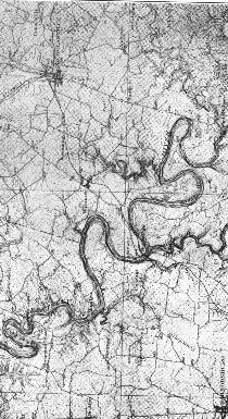
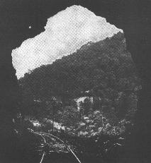 |
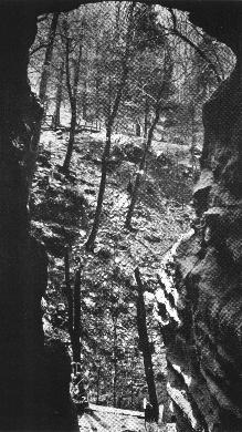
View out of the tunnel of the Chesapeake. Clinchfleld and Ohio Railroad down Big Sandy at "The Breaks." |
In the case of Mammoth Cave and Cumberland Falls such permanent losses are a certainty unless these areas be acquired by the State within the next year or two. With this idea in mmd the Kentucky General Assembly 1924-passcd a law (Senate Bill No.306, Truesdell) creatina a Kentucky State Park Commission of three members1 whose duties during the biennial period 1924-26, have been outlined to consist of an examination of available park sites in Kentucky, followed by selective recommendations to the legislature of 1926 concerning those which might be regarded as suitable. The reconimendations specified in the act are to be accompanied by suggestions as to the best methods of securing for the State One or more of these tracts by popular subscription, or gift of the land. No State funds are appropriated for the purpose of purchase. Deed in perpetuity is to be made to the State of Kentucky which shall be charged with their maintenance and control. This law, which will take effect during the middle of June, 1924, affords the first opportunity for systematic organization lookhig towards the establishment of one or more additional Kentucky State Parks.
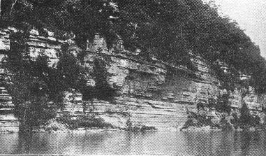
 |
On the craggy pinnicles close to the Cumberland River and above the gorge, many exquisite views of the Falls may be secured. |
Opinions will differ as to what kind of area should be selected for State park purposes. In general it may be indicated that no tract should be made a State park which does not present a high type of physical excellence, great natural beauty, or outstanding historic importance. Regions which exhibit at one point or another the scarred and defaced artificialities of man should certainly never be admitted to serious consideration. One or more fish and game preserves should be considered in order to inaugurate a broader conservation policy. Kentucky, blessed beyond her sister states in the central Mississippi Valley with natural wonders and beauties, and points of rich historic interest, has many areas which upon investigation will be found capable of meeting the most exacting specifications.
In any serious consideration of State park sites the Mammoth Cave, in Edmonson County, Kentucky, a world wonder of the first order, must necessarfly take first place. Foflowing close are: (2) The Carter Caves of Carter County, Ky.; (3) the Cumberland Falls in Whitley and McCreary counties, Ky.; (4) Cumberland Gap in Bell County, Ky.; (5) Natural Bridge in Powell and Wolfe Counties, Ky,; (6) The ''Breaks of Sandy" in Pike County, Ky.; (7) ''In Between the Rivers" in Lyon and Trigg Counties, Ky.; (8) die Ohio River Lowlands in Ballard County, or the Reelfoot Lake region in Fulton County; (9) a portion of the Kentucky River Gorge in Central Kentucky, in parts of Jessamine, Garrard, Mercer or Woodford counties; (10) and some one or two areas of special significance as regards the early history of Kentucky. Among these might he mentioned tracts at Harrodsbnrg or Boonesboro the points of first settlement in: Kentucky. These areas, all items of natural beauty and historic charm, constitute a tentative list of recommendations which have been presented for consideration to the Kentucky State Park Commission. No action has yet been taken by the Commisson looking towards an official examination or a possible acquisition of any of these tracts. All recommendations which may be made concenling these and other tracts will, however, be carefully considered with ways and means at a later date.
 |
Along the gorge of the Kentucky River there are many springs and subterranean streams that break over the cliffs as waterfalls or cascades. |
Many inquiries have been made as to the location, availability, and physical aspect of such areas as have been proposed from time to time as suitable for erection into a Kentucky State Park. It is the purpose of this paper to present a conisideration of the geological and physiographic conditions which obtain in these several areas together wifli a notation of some items of historical and human interest. In preparhig these descriptions the writer who has visited al1 of these localities during the last several years has drawn principally upon his own field notes. The inclusion of any particular area within this discussion does not, however, mean that it will receive favorable consideration, much less the approval of the Commission. For various fundamental reasons some tracts which have as yet never been proposed may possibly be among those finally selected. Looking toward final action which will merit universal approval the heartiest cooperation of all interested Kentuckians is solicited.
The first reference obtainable with respect to Mammoth Cave goes back to the year 1797 and is found on file in connection with a deed in the records of Warren County, at Bowling Green, Kentucky. In this paper the great cave is designated as a corner of a tract of land.2 Later in 1812 a deed of the Mammoth Cave tract from Flatt to McLean3 again appears in these county records. Due to a lack of exploration, though parts of the cavern had undoubtedly been used for many generations by the Indians, as some skeletal material and artifacts prove, the importance of the Mammoth Cave at this early time was not realized. So local tradition goes back to the hunter, Honchins, and his wounded bear. If fhe bear story is correct and by seeking refuge in the cave the bear caused it to he discovered, lie did more for Kentucky than any other bear either before or since his time. In making this observation no exception is taken to those wonderful bears that enticed he almost mythical "Long Hunters" across the Blue Ridge Mountains to revel in the unexplored wilderness of Southern Cerdral Kentucky many years before the appearance of Daniel Boone.
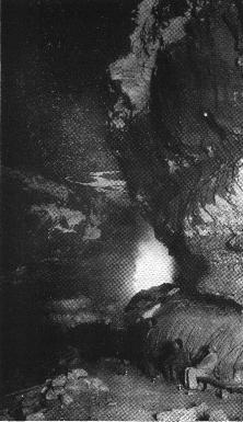 |
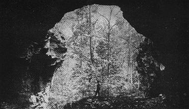
Of the many visual treats in the Mammoth Cave, none attracts more attention than the Star Chamber. Thousands speculate on this unique phenomena annually. |
From 1812 when it was used for the production of saltpeter for gunpowder manufacture to aid hi carrying of the war against the British, down to the present time Mammoth Cave has had an ever increasing fame and popularity. It is better known throughout the world and has been more largely written upon than any other single thing in Kentucky. One bibliography at least on the Mammoth Cave shows nearly one hundred titles,4 and it is said that at least 400 artides, many of them now unnamed and unknown, have been written and printed on the Mammoth Cave of Kentucky. Unfortunately for Kentuckians, Mammoth Cave located almost within the heart of the Blue Grass State enjoys a wider fame outside than within Kentucky. It has been said that fully seventy-five per cent of the thousands of visitors to Mammoth Cave come from distant points in the United States, Canada, or Mexico. Many are Europeans and the register kept at the cave shows names of tourists from all parts of the world.
The Mammoth Cave is situated in one of the most rugged and delightful portions of central- southern Kentucky in eastern Edmonson County within one half mile of Green River. The comitry rock of this section has been desigiated as the Mammoth Cave series of limestones, a group of calcareons formations many of which are nearly pure, and hence easily soluble. These limestones occupy a stratigraphic position in the lower part of the upper Mississippian system or sub-carboniferous rocks. Specificafly they are known as the St. Genevieve and St. Louis formations and are upwards of six hundred feet in thickness. They were deposited in clear open ocean water at a time in the remote geologic past just before the first great Coal Measures were laid down.
 |
It is the mecca of the proud and the humble, the rich and the poor, the young and the old. Of the tens of thousands who visit this region annually but a small part are native Kentuckians |
The Mammoth Cave region forms a part of the typical "Karst" area of Kentucky. It is embraced within the well defined Mississippian plateau of this State in which it has been estimated there exist between sixty and seventy thousand sink holes5 of varying sizes. Its subsurface drainage is so extensive that it is undoubtedly worthy of the desigiation as the type locality for Karst physiography in the entire United States. As in other ''Karst'' regions, particularly those in Southern Europe bordering the Adriatic Sea, the principal part of the drainage is subterranean. In this Kentucky locality water finds its way to the Green River by means of thousauds of sink holes to subsurface streams, some of which such as Echo River are of large size. Some short creeks and branches exist, hut ultimate drainage is almost without exception through one or more sinks--known to the farmers as "goose nests." A well known exposed subterranean stream typical of many unseen in this region is the "Lost River" near Bowling Green, Kentucky.
The extremely broken charaetenstic of the area about Mammoth Cave coupled with the low agricultural value of the soil have combined to the disadvantage of the farmer. The county limestone weathers to a dark blood red residual soil which is deficient in phosphorus, commonly quite stony, and readily washed into gullies. Fortunately these defects have resulted in preserving this wonderful region in something of its original beauty. The cavernous district surrounding Maulmoth Cave, and including the other large and well known caves, is in its broader feature a parallelogram bounded on the north by the Green River and extending southeastward over a territory of about seventy-five square miles. Its northern portion is almost entirely wooded in original and second growth timber, the principal species being the oaks, poplar, beech, hickory, walnut, ash, dogwood and a variety of conifers including the dressy little cedar which is quite abundant. With alternating cliff and gently sloping hilltops it is a singular continuation of limestone dells and coves, closed and open hollows, and picturesque little valleys which to the nature lover in the field apparently start nowhere and end nowhere.
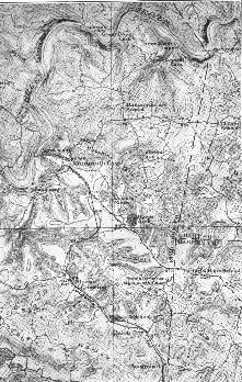 |
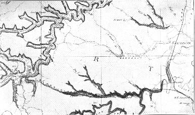
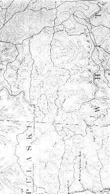
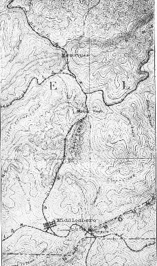
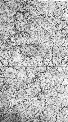
Parts of Barren, Hart and Edmondson Counies adjoin herein this unique Karst area. The contour interval is 20 feet and the scale 1 inch equals 1.5 miles. |
A glance at the new Mammoth Cave topographic quadrangle6 exhibits, however, some more or less well defined pattern or arrangement of the major sinkholes of this region. It will be noted that the largest sink hole in this section is an extended one some five miles in length lying just south of Mammoth Cave. Its head is just one mile west of Highland Springs, and its foot close above the Y. M. C. V. camp on the Green River. The new entrance to Mammoth Cave is located in the upper part of this sink valley just inside of the Edmonson County line.
The configuration of this large sinking valley iridicates that at an earlier time before its roof collapsed, it must, indeed, have been a very great and labryhthine cavern. Origirially it probably had many connections with the Mammoth Cave of which it may rightly have been important part. This great shik is bordered on the north by the Mammoth Cave proper, and on the south by another somewhat extended sirlichig valley, portions of which are known as Owens Hollow, Woolsie Hollow, Double Sink Hollow and Cedar Springs Hollow. This unusually large colapsed cavern, now an open valley, has its head at Chanmont and its foot at the Turnhold Bend of the Green River. Northeast of Mammoth Cave and separating it from Colossal Cave is a long line of deep sinks with its head in Hart and Barren counties. It is known as Houchins Valley.
Taken in their entirely these two collapsed caverns with their many sink holes and ponds exhibit a fairly well defined dendritic patters including that very important relationship the acute angle of entry with the major drainage of the region, the Green River. The ridges, attaining altitudes varying from 820 to 976 feet, are narrow and fairly flat. Their winding courses afford the only routes for the country roads which at their best in mid-summer or early autumn are none too good, and during the remainder of the year are next to impossible. Most of the larger sink holes vary from 100 to 175 feet in depth. The low water elevation on the Green River which is loced is 430 feet. A metallic government bench mark on the spur near the entrance to Mammoth Cav is 748 feet above sea level. One at Glasgow Junction, the nearest point on the L. & N. Railroad is 651 feet.
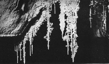 |
These interesting mineral formations twisted and turned into a thousand different shapes and figures are found in all of the caves of the Mammoth Cave region. |
Grouped about the Mammoth Cave, which is the principal and most widely known cavern of this section, are a number of others which if they are of more recent discovery and development are hardly of less importance because of their own unique and pattienlar attractions. Chief among these is tbe Great Onyx Cave, the New Entrance to Mammoth Cave, Colossal Cavern, and Great Crystal Cave. Other well known caves in this region are: Hidden River Cave, Horse Cave, Cranter's Cave, Dorsey Cave, Salts Cave, White 's Cave, Dixon Cave, Proctor Cave, Long Avenue Cave, Preston Cave, Highland Cave, Indian Cave, Parker Cave, Doyle's Cave, Cave of the Hundred Domes, Mammoth Onyx Cave, Diamond Cave, and Cedar Sink Cave. This long list of named caves, caverns and grottoes but faintly indicates the vast and intricate system of subterranean chambers which is found in the Mississippian limestones of this region.
A very large territory exists in this Karst part of the Green River Valley, which is yet entirely unexplored and it is more probable than otherwise that new caves will continue to be opened during the next 50 or 100 years, some of which may very possibly equal in fact both in size and beauty any of the caves which are now known. Mammoth Cave has been explored through various routes a total distance of 150 miles7 or more. It is altogether possible that if all of the subsurface ramifications of the caves of this section could be known and were plotted, the distance involved would exten into thousands of miles. An alignment of certain large sink holes and hollows of the Mammoth Cave region with their intervening plateau sections leads to the belief that large caverns will be found southeast of the Mammoth Cave, between Cedar Springs and Owens Hollow, and the great bend of the Green River of Turnhole Ferry.
The most important caves in Eastern Kentucky are those which are found in central Carter County on the waters of Cave Branch of Tygarts Creek, a northeast flowing tributary of the Ohio Riyer. The region has many sink holes, sinking branches, springs, natural bridges, and caverns. These caves like those of Edmonson County and others along the western border of the eastern coal field, the Pine Mountain, and in Westent Kentucky between the western coal field and the Cumberland River, occur in the lower part of the upper Sub-Carboniferous limestones. In this locality in Carter County they are designated as the St. Genevieve and Gasper, and attain a total measured thickness of ninety feet. These cavernous lirnestones are characterized by thin lamination, extreme cross bedding and the striking lithological combination of a highy calcareous aggregation of minute oolites generously intermixed with an abundance of very small rounded crystal quartz granules.
 |
Two intersecting joint planes in the St. Genevieve limestone, opened by solution produced the X Cave, one of the unique caverns of the Carter County Group. |
The limestone thus formed is generally very porous. Only occasionally is it found to be compact. Descending meteoric waters find in it the usual fracture, joint, and bending planes as lines of slight resistance, and at many points, because of its great porosity and extreme solubility, literally infiltrate the entire limestone series At the base of this calcareous oolite the thick non-soluable, crossbeded Logan formation sets in null provides an ultimate flow bed for all subterranean waters. These greenish clastics were formerly called Waverly Shales and constitute the lower part of the Mississipian system in this section. Nothing more than a part entrance such as that at Laurel Cave is ever developed in this formation as it is only removed by corrasion. In the northeastern portion Kentucky the thinnning of these Mississippian limestones to less than one hundred feeet has definately limited the vertical range of the caves.
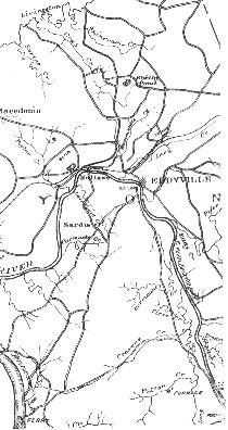
The Carter Caves are located in a maturely dissected plateau region. Hilly and with little good bottom land it is one of the rather sparsely settled portions of the State. Ridge elevations attain a maximum height of about 1,000 feet. The waters of Tygarts Creek at the mouth of Cave Branch is 695 feet above sea level. The surficial rocks in descending order are sandstones, shales and thin coats of the Coal Measures (Pennsylvanian) which in turn are underlain by the Gasper and St. Genevieve (Mammoth Cave) limestones and the Logan formation of the Mississippian. The indivicbial tract embracing the caves has been but slightly timber cut, arid for this reason the immediate surroundings present much that is naturally beautiful. The cave region is in fact a veritable oasis of original timber in a part of this State that is conspicuous for its rather complete deforestation.
 |
The construction of the new Midland Trail from Ashland to Lexington has made Carter's caves (upper left) very accessible. The scale of this geological map is 1 inch equals 3 miles approximately. |
Thus charmingly situated in an Almost primeval environment these caves offer many unexpected delights to the nature lover. Like Mammoth Cave, parts of these caverns were used for Saltpeter manufacture during the war of 1812. The Swingleton or Saltpeter Cave near the Lodge is particularly notable in this respect. In it are to be seen many relics of that day and time, old puncheon broad axed poplar planks, casts of saltpeter yats, and the open grave of a traditional Indian princess. The Carter caves center about a point well up on the headwaters of Cave Branch of Tygarts Creek. - They are all separate caverns and are named: Laurel Cave, Swingleton, X Cave, Cave Branch Cave, and Bat Cave. The last is the largest and in many ways one of the most interesting particularly with respect to its Stahictites and Stalagmites which assume many curious and fantastic shapes. Laurel Cave has a small lake, and X Cave takes the form of the letter for which it has been named. In this vicinity there are two magnificent natural rock bridges sixty to eighty feet above the streams which flow through them, and a third smaller rock bridge. These bridges like the caves are formed out of the Mississippian oolitic limestones. The Carter Caves proper are separate and distinct from those smaller caverns near Carter City which are widely known as the Oligoninik.
 |
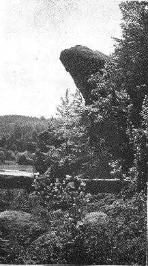
The two largest limestone natural bridges in Kentucky are found in the cave region of Carter County. Ages ago they were great caverns. Streams flow under each of them. |
The cave region is ten miles as the bird flies nortwest of Grayson from which point they may be reached with a wagon or automobile in the summer time. Tourists traveling in the Ohio Valley may take a short Tine railroad from Garrison to Carter, and thence to the Carter Caves by wagon or horseback. The elevation of the Carter County caves is about 800 feet, and the physical relief of the region is from 250 to 300 feet. The Carter Caves region unfortunately is not mapped topographically. It was located by the second Kentucky Geological Survey (Proctor) on a reconnaissance geological map8 of Carter County which has been exhausted in edition for many years.
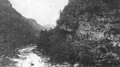
Kentucky's largest waterfall is situated on the Cumberland River 32 miles below Williamsburg in Whitley and McCreary counties. The Falls are 56 feet in height, the elevation above the falls rising gradually to a point slightly above the ford. The region is a wild and picturesque one. The Cumberland River comes down gracefully from the Pine and Cumberland Mountains flanked on either side by majestic forested hills, and plunges in wild and splendid beauty over a single conglomeratic ledge of the Lee sandstone. This formation is the basal part of the Pottsville group in Kentucky and is of early Coal Measure age. In it below the Falls is developed a deep gorge, narrow, boulder choked and tortuous in figure. The placid reaches of shallow and occasional riffle above the Falls are strangely contrasted with the violent swirls and currents of the river in the chasm immediately beneath and on down through the narrow confines of the wild and little frequented gorge.
 |
There is much in the Gorge of the Cumberland River to fascinate the eye of the nature lover. Giant Rocks tilted and overturned by a capricious river abound. |
The region has many trails leading to points of vantage from which delightful vistas may be obtained. There are at present, however, no first class automobile roads leadhg to Cumberland Falls. In the summertime it may be reached by light automobile without much difficulty from Cumberland Falls Station, a point 13 miles distant on the Southern Railroad. The Falls is 19 miles by nearest forest trail from Williamsburg and the territory covered is very rugged.
The Cumberland River has entrenched itself in a meandering course in the Cumberland plateau to a depth of 400 feet above the Falls. Although the terranes or the Cumberland Falls region, shales, sandstones and connglomerates, are all of Pottsville (Coal Measure-Pennsylvanian) age, the mineral resources are insignificant. The surface coals found here are thin, but the Hudson No. 2 a subsurface coal frequently attains on outcrop in the vicinity of Mill Creek a commercial thickness of five feet. What this seam might show in thickness immediately below the Falls is a pure speculation. While a number of wells have been drilled, neither oil nor gas has been found in commercial quantities. Most of the first class bard and soft wood has been cut out of this section, and nothing now remains except imperfeet first and second growth timber. The rough and broken nature of the topograpry coupled with the thin and unproductive character of the sd has resulted in very few clearings to the Falls, and none that are conspicuous. Thus it will be seen that the latent hydro-electric power value of this great waterfall is its only economic worth as contrasted to a glorious recreational area.
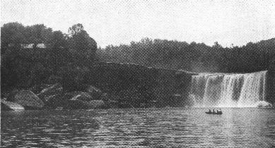 |
A beauty spot in every sense of the word. Kentuckians should know more about and value more highly this majestic waterfall. It possesses now every attribute of a well chosen state park. The pity is that it is not one already. |
An old rambling hotel which date back to Civil War times and before is situated on the conglomerate shelf which holds up this waterfall, and affords a kindly oldtime southern hospitality for tourists who pass that way. The region offers much to the nature lover, the fisherman, the hunter or the mountain cliniber and would all things considered, be ideal as a State Park site. During the past fifty years thousands have visited or summered at this point and have come to love it for its restful natural beauty and ruggedness.
 |
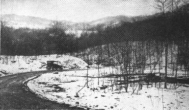
The traveller comes to Cumberland Falls Station (upper left) on the Southern Railroad and then makes the journey of 13 miles overland by auto or horseback. Contour interval 100 feet, scale one inch equals 3.5 miles approximately. |
Unfortunately commercial interests now propose to erect a dam about 87 feet high at a short distance above the water-fall thus creating a pool extending back to Williamsburg. A flume along the mountain side would, according to these plans, carry the Cumberland River except in timcs of flood to a point just below the Falls where it would drop cuto turbines a distance of 155 feet and provide a rather important hydro-electric power unit. Such procedure while undoubtedly feasible from every standpoint would rob Kentuckians for all time of the greatest waterfall in the State, and set aside permanently a tract which possesses the priceless charm of undespoiled nature. The introduction of this power project into a region naturally so uniqne and delightful seems little short of a great public catastrophe. Cumberland Falls was topographically surveyed on Cumberland Falls Topographic quadrangle, scale 1 :125,000, contour interval 100 feet, in 1886. This old map, somewhat generalized, was reissued in 1921, and may be obtained at Frankfort.
 |
There are many waterways back in the Cumberland Falls country that are not visted by man once a year. Though the best timber in many cases has been cut, the stand remaining is beautiful. |
In the sontheaster part of Kentucky on the Virginia-Tennessee line there is located an old water gap of magnificent proportion which takes its name from the Cumberland Mountains in which it is situated. Cumberland Gap, the former pathway of a great through-flowing river which headed at some distant points undoubtedly in Eastern Tennessee and Western North Carolin, is unique and dear to the hearts of Kentuckians in many respects. Abandoned as the result of the great piracy by the Powell River countless thousands of years ago, when the white man first came to this section it was already a gateway well known to the Buffalo and Indian. Dr. Thomas Walker passed throngh Cumberland Gap in his explorations of Kentucky in 1750, and there is little doubt since he apparently knew about it and made it an important objective, but that it had even af that early time already been found by some other earlier trading or exploring white man now long since forgotten.
 |
There is a scenic beauty attached to the Cumberland Mountains at "The Gap" that is individual. Once seen it will never be forgotten. |
It was through the Cumberland Gap and under the precipitous brow of Pinnacle Mountain rising to a height of 2,500 feet that Boone led the westward march of the early Kentuchy hunters and immigrants. This gap was the much used back door really the front door for a time-during the great migration and settlement of Kentucky. During the Civil War it was one of the naturally strategic points sought by the contending Union and Confederate armies. Today and for all time it will be the principal automobile thoroughfare from the northwest to to seaboard states of the Atlantic. Louisville, Lexington and Cincinnati are on the one side, Knoxville, Chattanooga, and Asheville on the other. It is on the direct and shortest line from Chicago to Jacksonville.
 |
A single visit to Cumberland Gap will convince the most skeptical that its claims as a park site are sound. Contours 100 feet apart, scale 1 inch equals 4 miles approximately. |
The Cumberland Mountain which the great gap is situated is one of the two true mountains of elevation in Kentucky. It rises in close proximity to the Gap to elevations of about 3,000 feet The mountain itself is composed of a series of elastic sediments, the most prominent of which as in the Pine Mountain on the other side of the Middlesboro syncline, is the Lee sandstone formation. It is a conglomerate and the lowest of the Pottsville group in Kentucky. The local geological section shows in association with this mountain making formation a series of sandstones and shales all belonging to the same early Coal Measure group. These beds have a thickness in this locality of 3,500 feet, and are underlain by the limestrnics and shales of Mississippian age which though comparatively thin in this section afford numerous sinks, caves, and caverns.
Situated on the edge of the important Southeastern Kentucky coal field, the mineral resources of the restricted Cumberland Gap region are practically of no value. Neither coal, nor oil, nor gas is found in here in commercial quantity or quality, and the mountain forming sarithstones themselves are not of sufficient hardness, for the most part, to provide suitable materials either for building or highway construction. Like other rugged areas in the Southern Appalachian coal field its agriculture is insignificant and far from self sustaining for the local population. The Gap region, however, though barren of much of material wealth, possesses great naural beauty and physical charm. It has besides, a very delightful climate particularly in the summer. Located on a long craggy mountain range in a region where many peaks though founded on but slightly disturbed sediments exceed that of flie great parallel barrier ridges-the Pine and Cumberland - -the ''Gap'' is a nation's gateway. This historic pass, 1,649 feet high, is readily accessible to auto tourists, for the well known Dixie A route, now complete in Kentucky passes through it. Travelers going by train will use the Louisville and Nashville Railroad.
 |
Kentucky has some excellent automobile highways in the mountains as well as in the Blue Grass. This winder view shows the Pineville-Middletown road on the way to Cumberland Gap. |
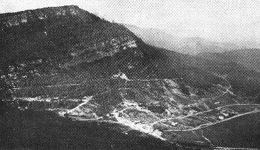
Standing on Pinnacle Mountain just above and to the east of the Gap a vista of from 30 to 50 miles over a sea of blue crested, timbered ridges is obtainable in most any direction. Here at this point come together three States; Kentucky, Virginia and Tennessee. Down below and to the northwest in a broad upland valley itself at an elevation of 1,200 feet above sea level is the thriving town of Middlesboro, one of the indnstrial marvels of the Kentucky mountains. Cumberland Gap is picturesque, strategic, historic. It possesses all of the physical qualifications of the ideal State Park site. It was topographically surveyed on the Cumberland Gap quadrangle, to the scale of 1:125,000 with a contour interval of 100 feet in the year 1882. A new edition was issued in 1917.
Among tbe natural bridges of Kentucky there is one which because of its size and accessibility is of outstanding importance. This is the great rock arch located on the dividing ridge between Wolfe and Powell counties in the Red River Valley in Eastern Kentucky. In an air line it is about six miles northwest of Campton and nineteen miles slightly northeast of Irvine. The local station is Natural Bridge on the Louisville and Nashville Railroad. Because of its proximity to central Kentucky and its case of approach it is yearly visited by thousands of tourists, many of whom are Kentuckians.
Natural Bridge itself is composed of the Pottsville congiomeratic sandstone which forms so outstanding a physical feature along tile western edge of the eastern coal field. Rock-house blocks of large size spafling off on either side on a narrowing strip of ridge conglomerate developed the first opening. Wind, frost and weather following in quick and helpful succession have served to widen the break in this old Coal Measure sandstone until today the arch is now high above the trail which leads up underneath it. The opening is 85 feet wide at the bottom. The bridge itself is 30 feet broad on top and is very strong and sound. It would easily support two heavily loaded railroad trains were it possible or advantageous to take them over it.
 |
Few Natural Bridges being in the Eastern United States possess the stately dignity of this splendid Eastern Kentucky sandstone structure. Its structural characteristic is more that of the great natural rock archves of the Rocky Mountains and the great West than those of the Appalachians. |
The region about Natural Bridge is one of great ruggedness. The Lee Conglomerate (Pottsville) forms all of the ridges as far as the eye can see and maintains a well defined accordance of plateau elevations ranging from 1,300 to 1,350 feet. Underlying this great sand stone stratum is found the usual sequence of limestones and siliceous beds of the Sub-carboniferous, which here as at many other points are cavernous and dented with rock houses and grottoes. Springs and sinks are numerous and one great balancing rock resembling a flattened sphere is a special feature of natural interest. Elevations in the valley on the Middle Fork of the Red River run about 800 feet, giviag a maximum relief for this section of 550 feet.
 |
Situated nearly midway between Stanton and Campton (lower right hand corner) Natural Bridge is in a very rough and maturely dissected country. Contour interval 100 feet, scale 1 inch equals 2 miles approximately. |
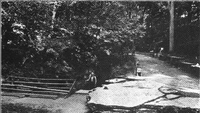
Some time ago the Louisville and Nashville Railroad sensing the scenic possibilities of this wild and rugged section acquired aid set aside the bridge region as a tourist park. It has been approved to the extent of a number of paths, steps, benches and a little artificial lake, but as now operated lacks much in the way of adequate hospitality for tourists coming from a distance no since no hotel is maintained there. It is a region which is susceptible of great things in a parkway and would, could it be secured, provide an excellent State park. The region was topographically mapped on the Beattyville quadrangle, scale 1:125,000, contour interval 100 in 1890. The present edition was printed in 1916.
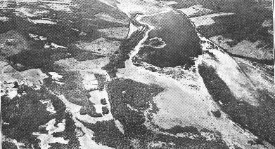
One of the most delightful spots in Eastern Kentucky from a standpoint of rugged picturesness and healthful climate is found in the vicinity of the "Breaks of the Big Sandy River." This region extends from a point about one mile northwest of the Kentucky line to "The Towers'' which are great separated sandstone pinnacles 1,596 feet high. These gigantic rocks towering above the high forested ridges, their sharp features clearly defined against the deep blue sky, have ever been a source of wonder and admiration to the traveler in this part of the Cumberland Mountains. They are situated two miles just southeast of the Kentucky line in Virginia. Geographically this wild and semi-primeval region crosses the great Pine Mountain which rises to normal altitudes in this vicinity of from 2,000 to 2,500 feet. Occasionally an individual peak like that at Skeggs Gap (2,773 feet), two and one-half miles in air line southwest of the "Breaks" attains somewhat higher elevations which makes it distinctive.
 |
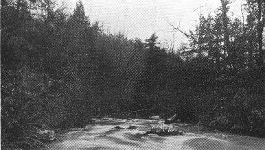
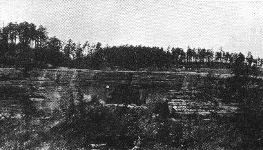
A rugged gash a quarter of a mile or more deep in thcik bedded resistant sandstone of Coal Measure age, the gorge of Sandy in Pike County at the Virginia line is by far the most scenic in Kentucky. |
The region surrounding the ''Breaks of Sandy'' is one which preserves and will continue to preserve for many years the rugged primeval grandeur of original conditions. Though in the heart of the Southern Appalachian coal field it is one in which little or no merit of commencial value exists either in the way of coal, oil, or gas and one which is too rough to allow of even the most painstaking kinds of mountain agriculture. The lack of mineralization in this region is due to the uplift and overthrust to the northwest of the lower conglomeratic members of the Pottsville series. These formations do not contain commercial coals. if oil or gas ever were trapped under the Pine Mountain anticline it has long since escaped through a thousand fractures.
The Russell Fork of the Big Sandy River at this point has maintained a "break" through the Pine Mountain uplift since the close of the Paleozoic era. On either side of this great sandstone gorge over 1,000 feet of continuous Pottsville (Coal Measure) strata may be seen. At points slightly removed from the "Breaks" this column of alternating shales, sandstones, and massive conglomerates may be extended to about 1,600 feet. The "Breaks of Sandy" is a water gap of particular significance in that it is one of three to cross the Pine Mountain range which, like a great sleeping giant with his feet in Tennessee and his head nearly in West Virginia, forms a part of the southeastern boundary of Kentucky and is about 90 miles in length.
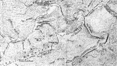 |
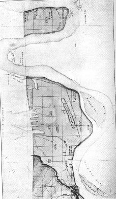
A portion of the Regina topographic map showing the physical character of the region near "The Breaks." Contour interval 50 feet, scale 1 inch equals 1.4 miles. |
Just inside of the Kentucky line in Pike County in a great meander of the Russell Fork there is a broad flat upland spur just south of the river which the stream has abandoned in the course of its meandering entrenchment. This area, essentially a plateau, with elevations varying from 900 to 1,050 feet, would afford a very excellent State Park site. It is surrounded on sides by high crested timbered mountains and is traversed by the Carolina, Clinchfield and Ohio Railroad. This tract though cleared at present affords but a very poor livelihood for a few scattered mountain farmers. The entire region is of little value except for hydro-electric power and scenic or park purposes.
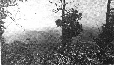 |
There are many views such as this from the top of Pine Mountain near the "Breaks of Sandy." The forest capped ridges whose summits are nearly the same elevation constitute the Cumberland Plateau. |
Along a boulder strewn course the young and vigorous Russell Fork of Sandy races through an inner gorge 150 feet deep which bounds this plateau on three sides. Fishing and camping sites abound of every direction. The summer climate is ideal, and the opportunities offered for mountain exploration are unequaled in the Southern Appalachians. The region may be most easily reached by rail from points in central Kentucky over the Chesapeake and Ohio Railway from Ashland. This route winding beside the graceful meanders of the Big Sandy and the Levisa Fork Rivers past the historic towns of Louisa, Paintsville, Prestonsburg and Pikeville threads one of the most picturesque and scenic parts of the Southern highlands. At the ''Breaks" along mountain trails bordered by laurel and dogwood, one breathes with exhilaration the romantic atmosphere of the great mountains. At dawn, at noontide, at nightfall the forest fragrances, the silences, the vistas, the overwelling experience of freedom and the sense of the primeval are magitificent and quite beyond description. Those who may be interested in this region made famous by Fox in his stories of the Cumberlands will find that it has been topographically surveyed on the Regina topographic quadrangle scale 1:62,500, coixtour interval 50 feet. This excellent map was issued in 1917.
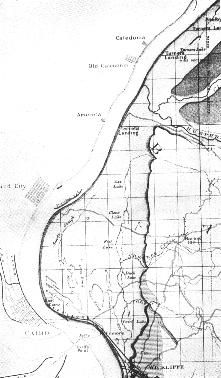
Any comprehensive system of State Parks should include one or more sizeable tracts set aside as game preserves and bird sanctuaries. Such action would be particularly fitting in Kentucky which at the time the first settlers came here, and for many years thereafter, was widely known for its wealth of wild life. Fortunately, although the original stock of many native species including the picturesque buffalo, the deer and the bear are gone, and hunting and fishing have long since ceased to be the principal occupations of the Kentuckian, there is a tract of the "Pennyrile" of Kentucky in southwestern Lyon County and western Trigg County (to be more exact) which would be ideal for this purpose. This region is situated west of the Cumberland and east of the Tennessee, and is known locally as "In Between the Rivers." The description is apt, for at Grand Rivers where the Illinois Central Railroad crosses this region on its way to Paducah, the Cumberland takes a great bend to the southwest and comes within three miles of meeting the Tennessee in its large bend to the northward.
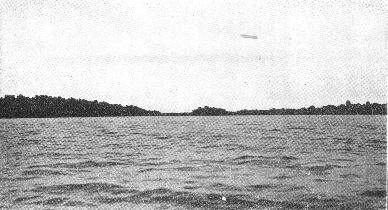 |
There are many islands in the lower waters of this river that remind one of the beauties of the Thousand Islands in the St. Lawrence |
Throughout this entire section these two major rivers are sepnratcd from one another by distances varying from five to seven miles. The territory thus almost surrounded by water in Kentucky is principally controlled in one large tract of upwards of 55,000 acres by the Hillman Land and Iron Co., a subsidiary of the Simmons Hardware Co.., of St. Louis, Mo., and was originally acquired for iron ore deposits which are know now not to exist in commercial quality, though they are large in area. Although extensively cut over in early times when these low grade ores were operated in a number of charcoal furnaces, the second and third growth of timber with some fire protection has replaced practically all deforested areas. What was two or three decades ago a succession of abandonded ridges and valleys is now almost a continuous young forest. Ideally situated for this purpose it is used at the present time by the State Game and Fish Commission as a State preserve for deer and turkeys and other small game. A special warden is maintained on this preserve by the State in connection with the Hillman Land and Iron Company, whose duties consist of daily patrol in protection of the game and extensive forests.
The surface presents a variegated broken landscape with an average physical relief of about 200 feet. The underlying country rocks are bedded limestones principally of the Mammoth Cave group (St. Genevieve, St. Louis) over wiucir extends a blanket of uriconsolidated sands and gravels of Cretaceous age. These loose, and in some cases badly washed sediments are in fact the most extensive outlier to the northeast of tlie sediments laid down in the old Gulf Embayment. Their soft rolling nature has caused them to spread rather completely over all residual limestones and soils undehying so that the entire region is one in which agriculture is unable to get a foothold.
 |
A portion of southern Lyon County, Kentucky, between the Cumberland and Tennessee Rivers. Scale of this map 1 inch equals 4 miles approximately. |
Naturally-fenced by water on three sides this territory in Western Kentucky is almost ideal for the purposes of a game preserve and bird sanctuary. Fenced on the south from the Tennessee to the Cumberland, arid over a short stretch on the north in the vicinity of Grand Rivers it could be developed as a magnificent State monument dedicated to the perpetuation of countless varieties of fauna native to this portion of the Ohio and Mississippi River va1leys. The region is extrenielv accessible being on the main line of the Il1inois Central Railroad from Lonisvlle to Paducah, the nearest station being Eddyville or Kuttawa. Unfortunately it has never been topographically mapped, but reconnaissance geological and geographic maps for this region available.9
Bordered on the west by the Ohio River and lying slightly northwest of Wickliiffe in Ballard County, Kentucky, there is a tract of lowland which was once the river bed of the Ohio. It is a tangled wildderness of vines and small shrubs extending as far as the eye can see under a canopy of great oak, poplar, cypress, hickory and other broad leaf trees. The region is marked by many small creeks and sloughs, and studded here and there with a score or more of little lakes. These fresh water ponds are all coiniected in the waters of Shawnee Creek and extend intermittently northwards almost to the mouth of Humphreys Creek which is a northwestward flowing tributary of the Ohio River. Except for some of the best timber which has been removed, this tract is practically in its orignal condition. Only a small portion is cleared arid under the plow. It is a natural reservation for game, birds and fish; a resort for all kinds of water fowl, and so thoroughly adapted to them that many of them spend the entire summer there instead of going further northward This is particularlv true of the brightly plummed and elegant wood duck.
 |
The lake or pond region north of Wickliffe in Ballard County is a natural preserve for fish, fowl, and small furred animals. Scale 1 inch equals 3 miles, approximately. |
The region is flanked on the east by a rather pronounced bluff about 150 feet high. This escarpment extends from Wickliffe to the mouth of Humplireys Creek in almost a north and south line and in figure and relationship to other structural features of this portion of the Mississippi valley is strongly suggestive of down faulting of a block of possibly considerable extent. These lowlands are made up entirely of soft river aluvium, and are, geologically speaking, very recent accumulations, possibly not more than a few hundred or a thousand years old. The bluffs which flank them on the east are either a brown loam, gray silt or bess of Quaternary age. The region comprises some 50,000 or 60,000 acres and parts of it are idealy adapted to the purposes of a bird and game sanctuary because of its topographic and geographic position. It is well known throughout Western Kentucky as a fishing and hunting paradise, many of the lakes being shallow enough for the hunters to wade them throughout; others deep enough to afford excellent bass fishing. Swan Pond, Minor Lake, Prairie Lake and Ox Lake are among the best known and most popular in this section.
Geologically, the region is a part of the old Gulf Embayment of Kentucky and Missouri. It has special interest in being a part of the most recent addition, geologically, to the State of Kentucky. This Ohio River lowland is owned to a considerable extent ill large individual tracts. Since it possesses no economic valne outside of its timber unless thoroughly ditched and drained, it is possible that without much difficulty some portions of it at least might be secured to block out a State park for fish and game purposes. It is easy of access on the raflroad either through Cairo, Illinois, or Wickliffe, Kentucky. The region has never been topographically surveyed, but it has been base mapped10 geographically and geoloically by reconnaissance methods which will serve for purposes of consideration.
 |
One of the few well known earthquake lakes, Reelfoot, with its upper waters tipped in Kentucky, is a natural area not to be overlooked. This airplane view show Walnut Log Hotel in the left foreground. |
This Wickliffe legion has been described as a type or ideal location of its kind. Farther up the Ohio River from Paducah to Henderson there are other similiar tracts forming a part of the southern shore or lowland, lake and pond studded for many a mile. It would be ideal for purposes of wild life, fish and game conservation if somewhere in this vast stretch of territory, fortuitous circumstances might result in locating a large State preserve through gift of deed to the land. Once acquired it would be easy and inexpensive to maintain. Under certain restrictions imposed by the State, it might indeed be made self sustaining.
 |
This is the westermost part of Kentucky--the bottom lands of the Mississippi River. Reelfoot Lake, something over 15 miles in length in Tennessee, just tips into Kentucky. Scale of this map 1 inch equals 4 miles, approximately. |
Possessing a striking physical similiarity to the Chain lake region of Ballard County, and undoubtedly a much wider reputation, the Kentucky or northern portion of Reelfoot Lake in Fulton County has much to recomment it as a State fish and game preserve park. The portion involved would include perhaps about five square miles adjoining the Tennessee line in the extreme southwestern part of the State. The highest land elevations here range about 300 feet as on Sassafras Ridge. The general level is about 295 feet and the waters of the Lake are but 290 feet. The bluffs which border the lake region on the east have a general elevation of 460 feet. Hickman, the seat of Fulton County, situated some half dozen mfles northeastward on the Mississippi River has a level elevation of 256 feet. As in the Chain lake region this section of Kentucky adjoins the Mississippi River. The formations surrounding Reelfoot take are valley alluviums, soft silts, sands and fine gravels of Quaternary age.
Reelfoot Lake was formed by an extended series of earthquake shocks, known as the New Madrid disturbance, which culminated in the changed course of the Mississippi River in 1811.11 Much has appeared concerning it in books and magazines. It is surrounded entirely by lowlands, the lake itself being shallow, particularly in many of the inlets or bayous. With its wealth of plant, animal and fish life it would make a splendid conservation park or preserve, a real paradise for the nature lover, scientist and disciple of Isaac Walton. Fringed by great sweeping vine laced trees with gloriously blossoming lily beds literally covering acres, it is at once a sight and a place not soon to be forgotten.
Last but not least among the many notable and scenically attractive portions of Kentucky, some part of the Kentucky River Gorge deserves serious consideration. The most picturesqne scenery is found from the vicinity of Camp Nelson down the river past High Bridge to Warwick. In this stretch of twentv-five miles by water the Kentucky River, an age old stream, has entrenched itself about 400 feet in a series of gray-white limestones, the oldest sediments exposed in the State. In this region following graceful meanders which carry one back to ancient days of peneplanation, the Kentucky River offers at most any point an ideal park site. Indeed, one of commercial nature has been maintained by the Southern Railroad at High Bridge opposite the mouth of the Dix River for a number of years.
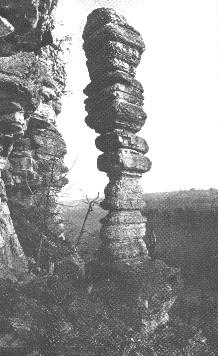 |
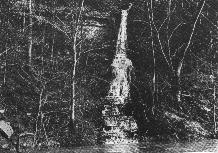
Several of these natural chimneys or candlesticks are to be found along the gorge of the Kentucky River in the Blue Grass Region. |
On either side the soluble Ordovician limestones present most interesting geological phenomena: caves, candlesticks, rock chimneys, rock houses, rock windows and doors, calcareous falls, trails, -and springs--all an inspiration to the nature lover. The bright ahnost perpendicular limestone walls of the great gorge are draped and festooned with many a vine and shrub. Like silken ribbons of emerald hue the narrow lowlands here richly carpeted with Blue Grass, and there platted with waving rows of corn and hemp stretch on endlessly from waters marge to walls of bold gray stone. The slow moving, government locked river mirroring on a summer's day the abrupt forest fringed cliff and the clear blue sky afford the canoeist and fisherman a haven of delight. Broad beaches of sand the burden garnered by this magnificent stream in its winding course down through the Eastern Kentucky coal field, provide at a number of points in the gorge splendid opportunities for bathing and water sports.
In the silent reaches of the river, particularly at nightfall, there is much yet to take one back to the days; of the pioneer. The occasional rudely built log cabin nestling aniotig the trees in or near the mouth of a cove, the fragrant odor of wood burning in an old time fireplace, and the melancholy piphig of some distant water fowl, create a priceless atmosphere of olden times. While breathing the spirit of a day gone by, mid falling dew and river mist, the traveler in these parts witi he very unlucky if he does not catch the strengthening aroma of good Kentneky country cured ham and find suddenly upon turning a sharp bend in the river, a well built Blue Grass farmhouse and open hearted Kentucky hospitality for the night.
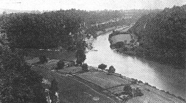 |
A splendid view showing the gorge of the Kentucky River (left) at the mouth of the Dix River. The latter stream is now being dammed for hydro-electric power. |
The gorge region of the Kentucky River is traversed by many country pikes and hard surfaced modern automobile highways. At high Bridge the river is crossed by the Southern Railroad whose gigantic steel structure stands 308 feet above the water level. A great hydro-electric power project is now nuder construction a short distance up the Dix River, and this will shortly afford a deep arid splendid spawning pond for black bass. It will insure in the course of the next few years excellent fishing in the Kentucky River at any point in close proximity to the mouth of the Dix River. While the river alluvium in the gorge is fairly rich, the diffienfly experienced by farmers at many points in getting their crops to the plateau above naturally makes these tracts of less value than others more fortunately situated in Central Kentucky. The region is mineralized at but a few points where calcite, barite and fluorspar occur as more or less vertical fracture and joint fillings. Omitting these, a very nominal value might be established for long stretches intervenirig which would be ideal for this kind of a State Park. It is possible that some tract or group of tracts might be secured by gift or popular subscription for this purpose.
 |
A portion of the Harrodsburg topographic sheet (scale 1:125,000) indicating the course and figure of the entrenched Kentucky River. The contour interval is 50 feet. |
The value and popularity of a park in the Kentucky River Gorge is already attested by the increasing number of campers now sununering in this locality. One of the larger recreational spots is Camp Daniel Boone which is located a few miles above Camp Nelson on the south shore of the river at the month of Otter Creek. This was the site of the historic Boonsboro, Kentucky's first settlement. Here it was that Boone planned a refuge in the wilderness, a deer and buffalo hunter's fortress far removed from civilization. Fortress in fact it became, and sooner than its founder had thought when bloodthirsty savages unnumbered crept down upon it and in merciless siege, threatened again and again in those early days its very existence. It was indeed a tirne for stout hearts and ready hands. Though dl traces of the rude stockade mid its cabins have 1ong since vanished a wealth of romailtic and pioneering tradition still pervades the atmosphere of this delightful locality.
 |
The gorge of the Kentucky River traversing the Blue Grass Region and but a few miles from either Lexington or Louisville is one of the most scenic in the state. |
 |
Within recent years the camper's tent and cottage have crept into maiiy a wooded cove along these placid stretches of the Kentucky River gorge, occupants coming from not only points in Kentucky but throughout both Northern and Southern States. At the present time there are 110 cottages dotted along this part of the Kentucky River between Irvine and Frankfort, and the total number of vacationistst summering in this part of thu State might be reckoned in the thousands. During the season certain beaches are literally crowded, visitors coming by automobile for the day only. A State Park with adequate up-to-date hotel accommodations surrounded by suitable temporary camping sites would be a success beyond any reason of a doubt. The possibilities of this portion of Central Kentucky as a great public playground during the summer months are almuost without limit. All that is needed here as in many other parts of Kentucky to bring about this larger utilization is a more general appreciation of the splendid opportunities afforded.
 |
Unfortunately all that many Kentuckians know about the picturesque Kentucky River gorge has been gained in a few fleeting seconds observation from a Southern train passing over this bridge. |
1. These commissioners are appointed for a two-year term and their duties are non-remunerative:
see Acts of 1924.
2. Hovey H. G., Mammoth cave, Kentucky, p. 9, 1909. J. P. Morton & Co., Louisville, Ky.
3. Jillson, W. R., Bibliography of Mammoth Cave. KY. Geol. Survey, series vi, vol. 10, pp.
148-156 inclusive.
4. Jillson, W. R., Bibliography of Mammoth Cave. Ky. Geol. Survey, Series VI, vol. 10, pp
148-156, inclusive.
5. Jillson, W. R., Land of Ten Thousand Sinks. Science, Vol, LVIII, No. 14; p. 184, Sept, 7,
1923.
6. U.S.G.S., Scale 1:62,500, contour interval 20 feet, 1923.
7. Hovey, H. C. Marnmoth Cave of Kentucky; p, 63, 1908. J. P. Morton and Co., Louisville,
Ky.
8. Hoeing. J. B. and Crandall, A. R., Geological Map of Boyd, Carter and Greenup Counties, Ky.
Ky. Geol. Survey, Series II Proctor, Scale of map 1 inch equals 2 miles. (1884)
9. Fohs, F. J., Geological Map of Trigg and Christian Counties, Ky., 3rd Geol. Survey. Scale 1
inch equals 2 miles: Also, Bissel, J. L., Geographic Mpa of Lyon and Livingston Counties, Ky.,
6th Kentucky Geological Survey. Scale 1 inch equals 2 miles, 1923.
10. Loughridge, R. H., and others. Geological Map of Jackson's Purchase, colored. Scale 1
inch equals 2 miles, occasional elevations. Ky. Geol., Survey, Series II, 1885.
11. Fuller, M. L., New Madrid Earthquake. U. S. Geol. Survey, Bull. 494, illustrated, maps, 119
pp. 1912; also Nelson, W A., Reelfoot-An Earthquake Lake in Tennessee. Nat. Geog., May, Vol.
XLV, No. 1, illustrated, pp. 94-114, Jan.. 1924.